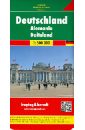
deutschland supertouring autoatlas 1 400 000
Модель:
RUR 1349
Deutschland Supertouring Autoatlas. M 1:400 000. Крепление: двойная евроспираль.
Модель:
RUR 1362
Schweden Supertouring Autoatlas. M 1:400 000. Spiral-bound Superatlas of Schweden at 1:400 000 scale that depicts elevation with shaded-relief and color tinting. The map pagesshow highways and roads, scenic routes, rail and ferry lines, ports, distances in kilometers. Thorough placename index. Крепление: двойная евроспираль.
Модель:
RUR 1244
Ungarn Supertouring Autoatlas. M 1:200 000. Spiral-bound Superatlas of Hungary at 1:200 000 scale that depicts elevation with shaded-relief and color tinting. The map pagesshow highways and roads, scenic routes, rail and ferry lines, ports, distances in kilometers. Thorough placename index. Крепление: двойная евроспираль.
Модель:
RUR 1485
Deutschland Supercompact; Alemania Supercompacto Touristische Informationen, Ortsregister mit Postleitzahlen, Cityplane, Durchfahrtsplane, Entfernungen in km. 1:300 000 Крепление: двойная евроспираль.
Модель:
RUR 1123
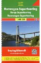
Spiral-bound Superatlas of Norway at 1:400 000 scale that depicts elevation with shaded-relief and color tinting. The map pagesshow highways and roads, scenic routes, rail and ferry lines, ports, distances in kilometers. Thorough placename index. Крепление: двойная евроспираль.
Модель:
RUR 666
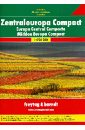
Central Europe Compact. Autoatlas. 1:700 000.
Модель:
RUR 1164
Germany. М 1:500 000. Touristische Informationen. Ortsregister mit Postleitzahlen. Entfernungen in km.
Модель:
RUR 1660
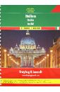
Italien. M 1:150 000 / 1:400 000. Крепление: двойная евроспираль.
Модель:
RUR 2288
Touristische Informationen, Ortsregister mit Postleitzahlen, Cityplane, Stra?enverzeichnis, Campinplatze, Entfernungen in km. Laufzeit bis 2014 16, 471, 64 S. m. zahlr. farb. Ktn. u. Pln. 30 cm 1850g 1:250.000 u. 1:400.000 Spiralbindung , in englischer, franzosischer, niederlandischer / flamischer, deutscher, norwegischer, schwedischer, danischer und finnischer Sprache. Крепление: двойная евроспираль.
Модель:
RUR 937
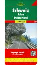
A detailed road map of Switzerland at a scale of 1:400,000 (1" to 6 miles).The road network is classified along with route numbers and distances. Map details include railways, airports, gas stations on the Autobahn, scenic and tourist routes and scenic viewpoints and places of interest. Cantons are outlined. The index book of communities includes postal codes and center city plans of Basel, Bern, Geneva, and Zurich. The legend is in English, Italian, French and German.
Модель:
RUR 937
This map appears in the map series world mapping project in travel expertise. Characteristic is the high-quality, clear and modern cartographic representation. Contour lines with elevation Coloured elevation levels Classified road network with distances Places of interest Detailed local index GPS capability by longitude and latitude UTM grid.
Модель:
RUR 1423
This map appears in the map series world mapping project in travel expertise. Characteristic is the high-quality, clear and modern cartographic representation. Contour lines with elevation Coloured elevation levels Classified road network with distances Places of interest Detailed local index GPS capability by longitude and latitude UTM grid
Модель:
RUR 937
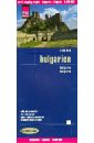
Explore Bulgaria with this Freytag & Berndt road map. The best way to plan your trip, prepare your itinerary, and to travel independently in this country.
Модель:
RUR 1423
This map appears in the map series world mapping project ™ in travel expertise. Characteristic is the high-quality, clear and modern cartographic representation. Contour lines with elevation Coloured elevation levels Classified road network with distances Places of interest Detailed local index
Модель:
RUR 2682
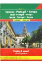
Spain-Portugal-Europa. M 1:400 000 / 1:3.500 000. Крепление: двойная евроспираль.